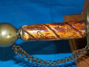


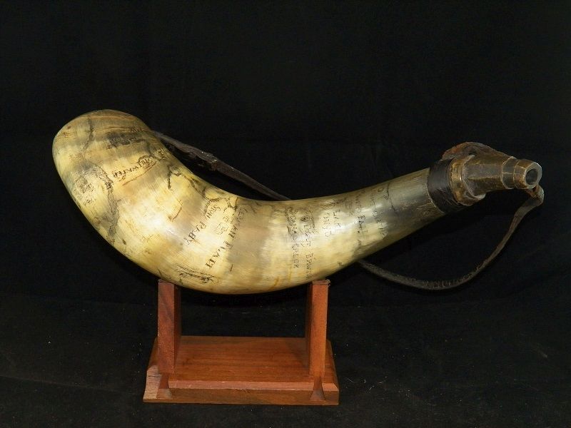
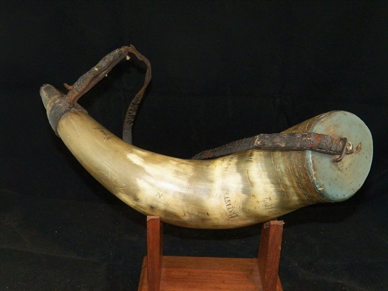


This is a fairly large Powder Horn with an O/A length of 16". It exhibits a map of upstate New York and lower Canada from Lake Ontario to Montreal than south to Albany . The name "Batiste" and August 17,1802 would lead me to beleive he was the original owner of this beautful horn. I believe the August 17,1802 dated was added later as it is in a different hand and style then the rest of the engraved map. This is fairly common on Old Powder Horns as they were passed on from one generation to the next. The map contains many old Forts such as German Flatt, Stone Raby(Stone Arabia), Ft.Harkman, Ft.Henry, Ft.Hunter, Stillwater, Ft. Brwton, and Canad Creek. There is an engraved depiction of "a man and a Indian paddling a canoe". The man is sitting in the back and wearing a cap while the Indian in the front is wearing a feather. The horn still exhibits most of it of an old green milk paint on it's base. Also, it's original carrying strap. A very good looking early Powder Horn
Sold
Campaign Powder Horn-Map
"French & Indian War
&
Rev. War"
Sold
Questions? Reach Out!